 View All
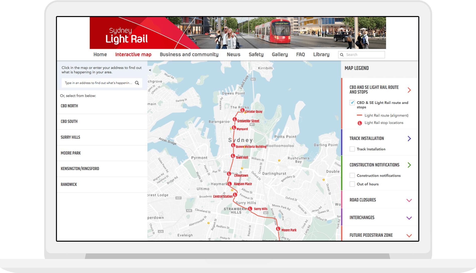
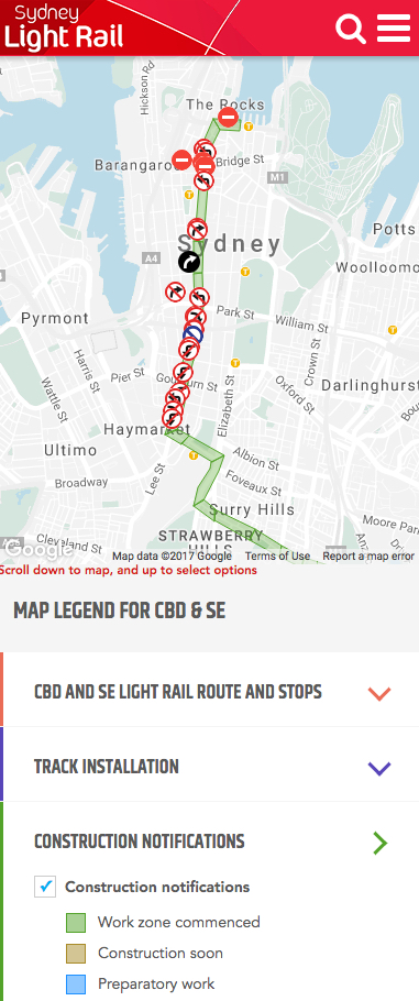
Sydney Light Rail Interactive Map
This interactive map utilises layered filters to display multiple datasets depicting the current and planned light rail networks in the city.


How to inform the public of light rail developments and the effects on the transport system?
The interactive map includes construction notifications, light rail routes, interchanges, future pedestrian zones and what percentage of track has been installed for each section of the line.
It includes disruption notices for drivers who travel through key parts of the city.
Responsive mobile design was a key aspect for commuters requiring up-to-date information when travelling into and around the city.
Related projects and articles
-

Andrea Lau in conversation with Andy Kirk: Explore Explain podcast
Article
-

COVID-19 Socio-Economic Recovery Data Insight Platform
United Nations Development Programme
-
Occupational Risk due to COVID-19 in NSW
Article
-

Mapping all the frogs in Australia
Australian Museum